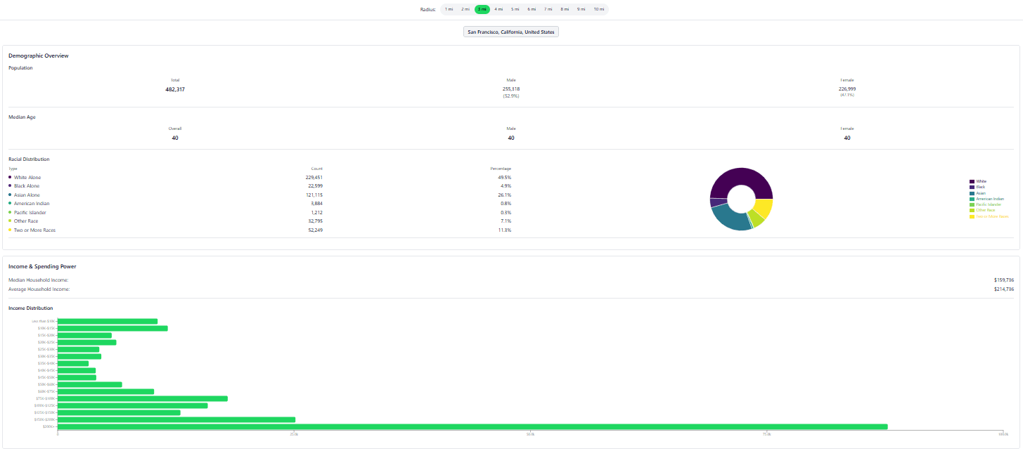
Demographics Report
Custom demographic insights to support investment decisions and site selection.
From deal discovery to risk assessments, reSpots unifies the reports self-storage teams need to move 10x quicker.

Generate detailed market reports instantly. Includes FEMA flood zones, wetlands, zoning, crime, and demographic overlays. Built-in CRM to organize and save your properties.
Built specifically for industry professionals. Includes rate grids, demand indicators, zoning, rent comps, and environmental overlays in one place.
Auto-sorts through on-market listings. Flags properties that match your self-storage development criteria. Saves hours of manual site-scanning and underwriting prep.
Deal Sourcing Tool
Turn the firehose of on-market listings into a shortlist of opportunities matched to your investment profile.
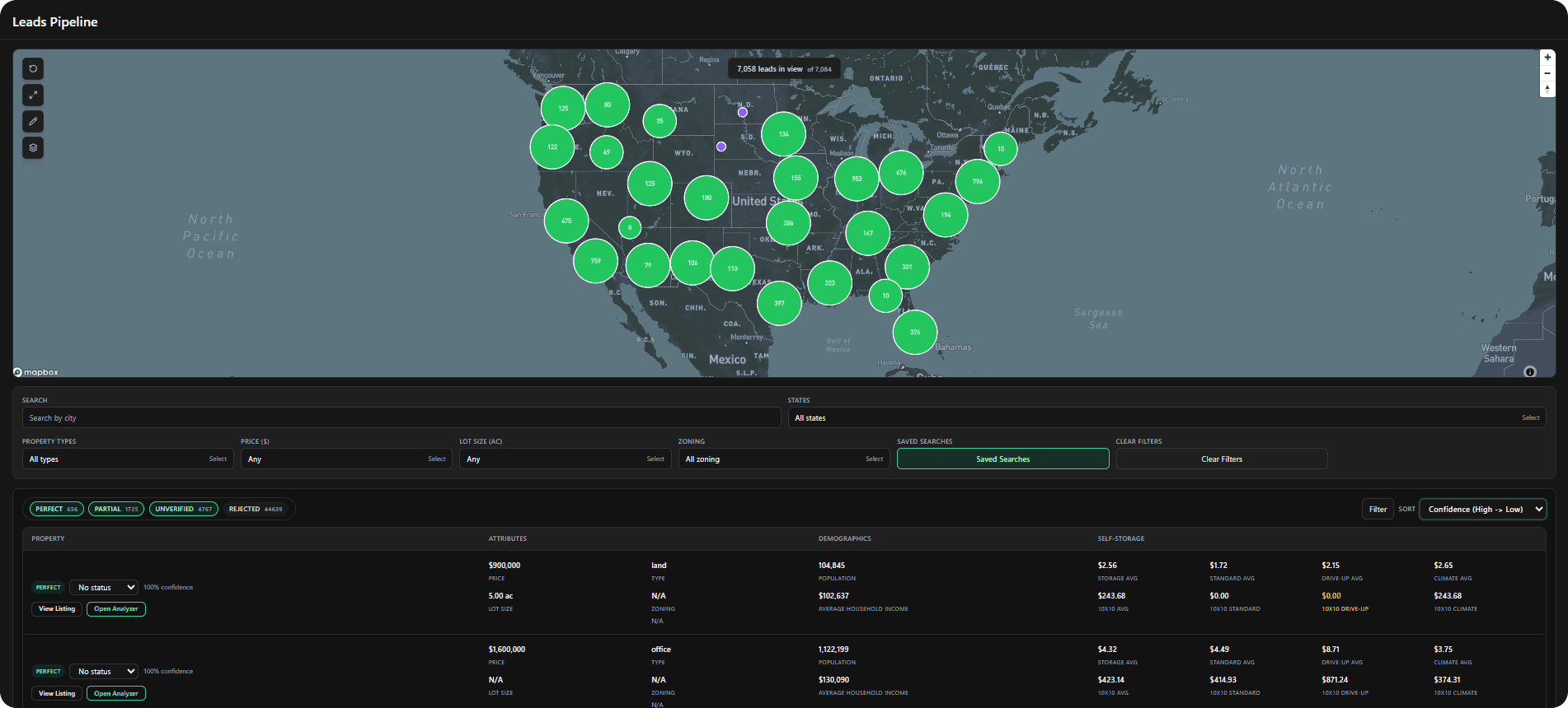
On-market listings are continuously scanned against your self-storage criteria so you never miss a fit.
Dial in parcels by unit mix, square footage, and market factors tailored to storage development.
Move high-potential sites from discovery to underwriting with a shared pipeline that keeps teams aligned.
Reports & Data
Custom demographic insights to support investment decisions and site selection.
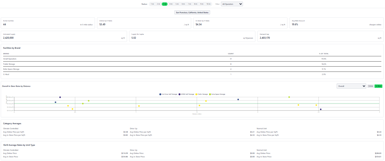
Daily self-storage rates to support investment decisions and site selection.
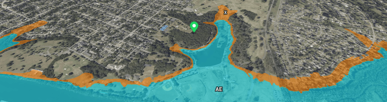
Clear zone identification (AE, X, VE) with floodplain boundaries and Base Flood Elevation context.
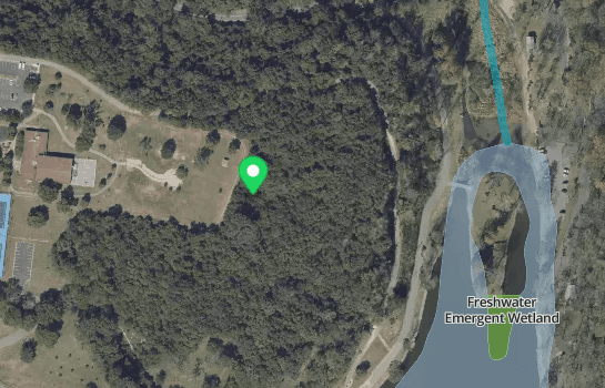
NWI wetlands identification with buffer zones and permitting risk assessment.
| Category | Other Analysis Tools | |||
|---|---|---|---|---|
| Site-Selection | ✕ | Focused only on analyzing sites after you've found them | ✔ | Helps you discover submarkets with visual tools that match your criteria |
| Market Discovery | ✕ | You have to find the markets yourself first | ✔ | Exposes high-potential markets instantly with visual layers |
| Property Analysis | ✕ | Basic industry data + demographics | ✔ | Includes industry data, demographics, crime, wetlands, FEMA, zoning |
| Track Properties | ✕ | No property saving or tracking tools | ✔ | Save, tag, and share properties — add listing info directly |
| Time to Find Sites | ✕ | 4–5 hours of scattered workflows | ✔ | <1 Hour using one unified platform |
Book a 20‑minute demo or explore live markets.